Bridleway 23 (East Hatley)
Direction roughly SE – NE Distance: c.400 m. Back
to map
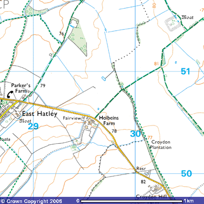 Bridleway 23 starts on the Hatley to Croydon Road opposite
Holbeins Farm at about 77 metres above
sea level (TL 296505). In the 1840s a large white brick farmhouse was built,
replacing what was known formerly as Carters Farm. According to the Royal
Commission of Historic Monuments:
Bridleway 23 starts on the Hatley to Croydon Road opposite
Holbeins Farm at about 77 metres above
sea level (TL 296505). In the 1840s a large white brick farmhouse was built,
replacing what was known formerly as Carters Farm. According to the Royal
Commission of Historic Monuments:
(9) CARTER’S FARM,
L-shaped, two-storeyed, of white brick with hipped and slated roof; c. 1840.
the N.E., front elevation has five sash windows and a
central front door with latticed fanlight. The lower rear wing houses offices.
The bridleway continues northeast for about 350
metres until it reaches the parish boundary of East Hatley and Arrington (TL
298508) where it meets Footpath 5. This path runs south-southeast along the
boundary with Arrington to meet the road at Croydon Hill Farm. Continuing
northeast is Bridleway 23 which leads to Ermine Street just north of Valley
Farm.