Footpath 9
Direction NE – SW
Distance: c.
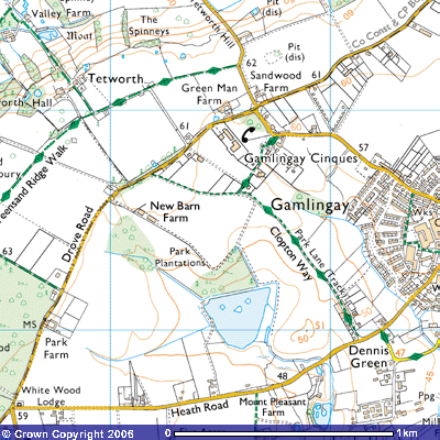
Footpath 9 is a route from Park Lane, Footpath 8, to Gamlingay Cinques, sometimes
written as Gamlingay Sinks. It starts (or finishes) at the junction of the farm
track with Park Lane, by a stand of silver birch trees forming the edge of Old
Plough Farm, a late-20th century bungalow on the Clopton Way (TL226526). A
small yellow arrow on a fence post highlights the route.
![]()
![]()
![]() Aerial
photographs of the fields to the southwest, near New Barn Farm, show a ridge
and furrow pattern, the medieval field system where peasants farmed a long,
narrow strip of land earthed up into a ridge. The furrow was the dip between
each strip (SMR 11394; TL 22155265) To the north, aerial photographs indicate
some rectangular earthworks around an oval hollow, damaged by a sand pit on its
northern boundary. Their date is unknown but they appear to be old field
boundaries. (SMR 09969; TL 2265170) Thomas Langdon’s 1601 map describes this
field as Comon behinde Wellefes. The word Wellefes is written
over several fields to the east where Ashpole House is built.
Aerial
photographs of the fields to the southwest, near New Barn Farm, show a ridge
and furrow pattern, the medieval field system where peasants farmed a long,
narrow strip of land earthed up into a ridge. The furrow was the dip between
each strip (SMR 11394; TL 22155265) To the north, aerial photographs indicate
some rectangular earthworks around an oval hollow, damaged by a sand pit on its
northern boundary. Their date is unknown but they appear to be old field
boundaries. (SMR 09969; TL 2265170) Thomas Langdon’s 1601 map describes this
field as Comon behinde Wellefes. The word Wellefes is written
over several fields to the east where Ashpole House is built.
A grassy path takes you northeast into Gamlingay Cinques, To the
northwest you pass a number of smallholdings behind which is ARMFIBRE, a
factory making reinforced plastic products for pollution control.
Extensive tree planting, pig rearing and market gardening following
enclosure have altered the natural vegetation of Gamlingay Great Heath. The
Wildlife Trusts have set up this nature reserve at Gamlingay Great Heath and
are reintroducing heath land to help conserve some of the natural habitat.
Sheep grazing is to be reintroduced. The reserve includes a pit dug for the
Cambridgeshire Greensand needed in the construction industry. When the pits
were first excavated is uncertain but thought to be after 1844 Enclosure Act.
Other overgrown pits or hollows that dot the fields along the top of the
Greensand Ridge in this area are remnants of this old industry. In wet weather,
you can see pools of water where rainwater has not yet managed to drain into
the Gault Clay beneath.
Naturalists have been attracted to these heath lands for centuries. John
Ray, often referred to as the father of English natural history, described
plants on Gamlingay Heath in his Catalogue of Cambridge Plants published
in 1660. The reserve contains a variety of habitats unique to Cambridgeshire,
from wetland plants in the damp hollows to heath and woodland on the dry acidic
Greensand. Over the years, 22 different plant species have been found. When one
is walking through the countryside one of the measures used to determine how
old a path or trackway is, is to count the number of species and multiply by
100. This gives 2,200 years for Gamlingay Cinques, a reasonable date for when
the trees might have started being cut down. On the wetter soils you can find
St. John’s wort, cuckooflower, bent grass, sedges and rushes. On the drier
soils there are heathers, heath bedstraw, harebell and heath grass. There is
also gorse and areas of maturing woodland .including pollarded oaks, cut off at
shoulder height to stimulate new straight growth above the heads of grazing
cattle.
Once you reach the car park at the edge of the nature reserve you have a
choice of routes. Following the road through the predominantly 19th
century cottages takes you down Cinques Road, mostly along the pavement back
into Gamlingay. An alternative route is to cross the eastern edge of the common
towards the slate-roofed Victorian cottages where a farm track takes you back
to Footpath 8.
The settlement of Gamlingay Cinques is old. A 17th century
thatched cottage can be seen on the corner by the workshops and sheds of R. G.
Hills and Sons Ltd, Potato Merchants and Hauliers.
White Horse Public House
Immediately past it is a kissing gate giving access to Cinques Common
Nature reserve.
You can walk through the Nature Reserve back onto
Drove Road and come back down Footpath 8 to the same spot.
Aerial
photographs have revealed a medieval field system in the fields to the north
with its ridges and furrows (SMR 11401)